


Phobjikha is a beautiful high-altitude valley in central Bhutan, in Wangdue Phodrang District, about 4–5 hours from Thimphu and around 2–3 hours from Punakha. It is famous as the winter home of the black-necked cranes and is also known for potato farming, which is an important part of life in the valley. Gangtey refers mainly to the village and monastery on the upper side of the valley, while Phobjikha refers to the wider valley below. The two names are often used together, with the area also known as the Gangtey Valley. The Gangtey Nature trail (Gangtey-Phobji Trail) is a 4km walking route that provides beautiful overall views of the Phobjikha valley.
I had travelled through the Himalayas several times before arriving in Phobjikha, so I thought I had a reasonable idea of what to expect. Mountains, monasteries, winding roads, villages, prayer flags and the occasional moment when you wonder whether the road ahead was designed by someone with a personal dislike of cars.
This was my first visit to the valley, and by the time we arrived, my guide Sonam had already been with me for several days. He had accompanied me from Paro, so the journey to Phobjikha was part of the experience rather than simply a transfer from one hotel to another. Along the way, he pointed out villages and places of interest, answered my questions patiently and tolerated the large number of photographs I insisted on taking through the car window.
I arrived in Phobjikha in May, and the weather seemed undecided about whether it wanted to welcome me. The morning was cool and rather gloomy, with a light spell of rain coming down as we made our way towards Gangtey. It was hardly the sort of weather that encourages you to lace up your walking shoes, but after coming all this way, a little rain was not going to deter me.
By the time we reached Gangtey, I was ready to explore the valley on foot. Sonam suggested the Gangtey Nature Trail.
At around four kilometres, it sounded perfectly reasonable. I have walked plenty of trails in the Himalayas, so I was not particularly concerned. Four kilometres is hardly an expedition. In Australia, I would probably describe it as a pleasant afternoon walk.
Of course, Australia has a rather different definition of altitude.
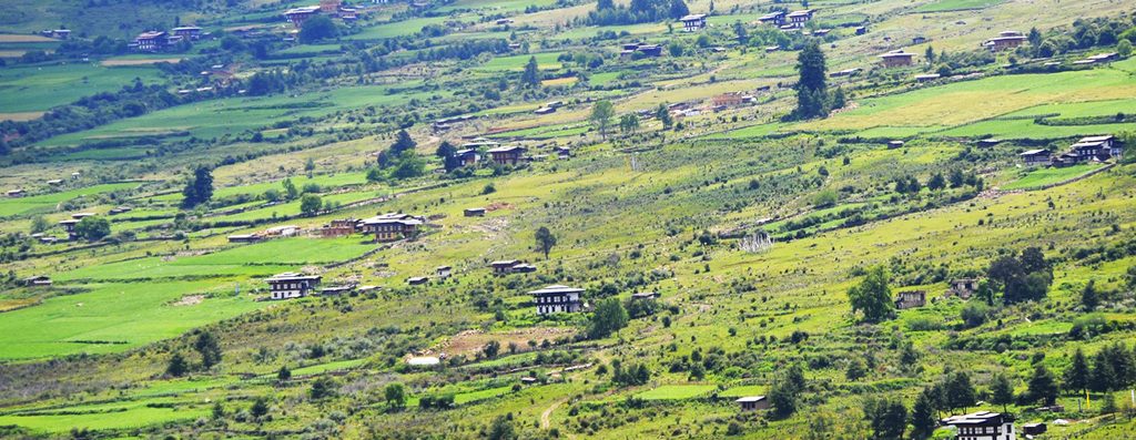
The Gangtey Nature Trail begins near the fantastic Gangtey Monastery. Sonam and I walked towards the gate before taking the off-road path that descends from nearby, leaving Gangtey village behind us.
Within a few minutes, the surroundings changed completely. The houses disappeared and we entered a forest of pine trees. The trail headed downhill, and the atmosphere became noticeably quieter with every step. There were birds everywhere, and I could hear them clearly, but there was almost no human noise. No traffic. No machinery. No voices carrying up from the village. The forest seemed remarkably undisturbed.
I have spent enough time travelling in the Himalayas to know that quiet places are becoming increasingly precious. Even in remote areas, you can usually hear a vehicle somewhere in the distance or encounter people going about their daily business.
Here, for a while, it was simply Sonam, me and the birds. The trail was also very easy to follow. Arrows clearly marked the route at different points, so there was little danger of taking a wrong turn. I still followed Sonam closely, however. There are limits to how much confidence one should place in one’s own sense of direction.
We continued downhill through the pine trees, with the forest occasionally opening enough to give us glimpses of the landscape beyond. The walk was pleasantly unhurried. Sonam knew the route well and stopped from time to time to point out things I might otherwise have walked straight past. That is one of the advantages of travelling with a local guide. A landscape that initially looks like “some trees and a mountain” starts to reveal its details. He would occasionally point out indigenous plants and flowers, explaining which ones were used for medicinal purposes. I wish I could tell you what they were called, but clearly I was more interested in admiring the scenery than committing their names to memory.
Eventually, we reached a more open area. After the enclosed forest, the change was striking. The path continued downhill through open countryside, and the views became broader. The valley was beginning to reveal itself, although I had no idea yet just how impressive the view would become later in the walk.
We soon came towards a village. The road through this section had recently been pitched, which gave it a slightly more finished appearance than the forest path we had followed earlier. Traditional houses and farmland surrounded the road, and the scene had the unhurried character of rural Bhutan.
Then we encountered some local traffic. Cows. Several of them were making their way along the road, completely unconcerned by our presence. I stopped to take a photograph, which Sonam seemed to find mildly amusing. I explained that the cows looked particularly photogenic.
He politely disagreed.
A little further along, we came across a white chorten. It stood quietly beside the route, surrounded by the countryside. There was no crowd gathered around it and no sense that we had arrived at a major tourist attraction. It was simply part of the landscape and part of everyday life in the valley.
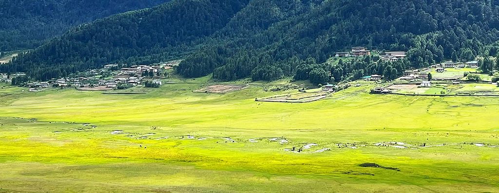
One of the things I appreciated about the trail was this mixture of natural and cultural scenery. We were passing through a landscape where forests, farmland, villages, religious sites and grazing animals all belonged together. That made the experience feel much more connected to Phobjikha itself.
From the village, the trail climbed gently for a short stretch before taking us back into the forest. This section was narrower, with the path winding between the trees. The ground was soft with pine needles, and the forest once again became quiet around us.
But this time, there was something quite spectacular waiting on our right. Through openings between the trees, we could see the vast Phobjikha Valley below. Every few minutes, another gap in the forest revealed more of it.
I would stop. Sonam would stop. I would take another photograph. Sonam would wait.
This became a fairly predictable pattern.
I have always found that walking through a landscape gives you a much better understanding of it than simply driving through. From the car, you see the valley as a picture outside the window. On foot, you begin to understand its scale and how the different parts of the landscape fit together.
And Phobjikha has plenty of scale.
Eventually, we reached the viewpoint. After the narrow forest trail, stepping into the open space was almost like pulling back a curtain. The entire Phobjikha Valley lay before us.
The valley floor stretched out beneath the surrounding mountains, with fields, settlements and patches of forest spread across the landscape. From this height, the openness of Phobjikha was immediately apparent. I had seen photographs of the valley before coming here, but photographs have a habit of making places look flatter and smaller than they actually are. This was much bigger.
I stood there for a while without saying much.
Sonam, having presumably seen the view hundreds of times, seemed considerably less overwhelmed than I was. That is one of the privileges of being a guide. You get to watch other people discover your country over and over again.
I took another photograph. Just in case.
From the viewpoint, we continued towards the Phobjikha Chorten, the long white chorten standing prominently on a hill above the valley. The trail gradually descended, and the valley floor seemed to come closer with every step.
And we still weren’t finished. The path continued down towards the valley floor.
The closer we got to the bottom, the more intimate the landscape became. From the viewpoint, Phobjikha had looked enormous. Down on the valley floor, I could see the details again: fields, houses, paths and the small features that make a rural landscape feel lived in.
This was another part of the walk I particularly enjoyed. There was no dramatic transition. The valley simply changed around us as we descended. Eventually, we reached a wooden bridge.
We crossed it and continued towards Khewang Lhakhang, bringing the walk towards its lower end.
By this stage, I was pleasantly tired. Four kilometres had turned out to be exactly the right length: enough walking to feel that I had properly experienced the valley, without requiring me to make an embarrassing request for Sonam to arrange a rescue vehicle.
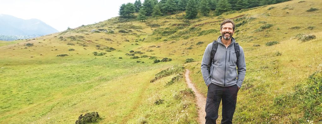
The Gangtey Nature Trail was my first real introduction to Phobjikha, and I think walking it was the right way to meet the valley. It would have been easy to drive through, stop at a viewpoint, take a few photographs and move on. Instead, the trail allowed me to experience the landscape gradually. I left the village and entered the pine forest. I listened to birds in the quiet. I walked through the countryside and watched cows wander past. I passed a white chorten and a village before returning to the forest. I caught glimpses of the valley through the trees and then, eventually, saw the entire landscape from the viewpoint.
By the end of the trail, I had developed a rather strong affection for Phobjikha.
Perhaps it was the silence. Perhaps it was the enormous valley opening up below the forest.
Perhaps it was the feeling of walking through a landscape where the scenery, villages, animals and religious sites all seemed to belong naturally together.
Or perhaps it was simply that, after travelling through so many parts of the Himalayas, I had finally found somewhere that made me slow down.
Whatever the reason, I knew I would remember that walk. And I also knew one other thing.
The next time Sonam tells me a Himalayan walk is “only four kilometres,” I am bringing a larger lunch.
